Rajant Peregrine and Hawk nodes are in stock now! Find Out More
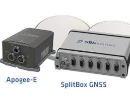
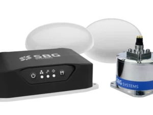
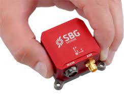
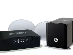
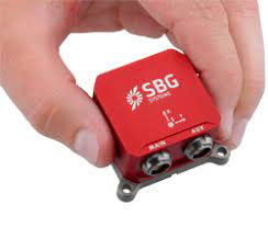
Apogee-E: Versatile Inertial Navigation System
Apogee-E is a highly accurate Inertial Navigation System that connect to a SplitBox GNSS or any survey grade external GNSS receiver for optimal navigation. The ITAR Free Apogee-E is the most accurate and versatile INS based on the robust and cost-effective MEMS technology.
Downloads
High Accuracy:
- 0.008° Roll & Pitch (RTK)
- 0.02° Heading (Depends on GNSS receiver)
- 1 cm Position (Depends on GNSS receiver)
- 5 cm Real-time Heave
- 2 cm Delayed Heave
Apogee-E embeds:
- The latest MEMS gyroscopes and accelerometers
- A Web Interface for Easy Configuration
- A 48h Internal Data Logger for Post-processing
Positioning with an External GNSS receiver
The Apogee-E connects to any survey grade GPS/GNSS receiver to provide navigation data. GNSS information is fused in real-time with inertial data to provide the best performance. It features a unique GNSS error model to take into account every receiver specific behaviours.
Positioning with a SplitBox GNSS
The SplitBox GNSS integrates the latest generation tri-frequency GNSS receiver that supports RTK and Precise Point Positioning (Marinestar, TerraStar, Veripos, OmniSTAR, etc.). It also provides raw data for Post-Processing. The SplitBox GNSS embeds a Dual Antenna receiver for highly accurate and robust heading in every dynamic conditions.
Extensive Heave Calculation
The Apogee provides a real-time heave accurate to 5 cm. For more simplicity, the user doesn’t have to enter the wave frequency; the Apogee automatically detects it and constantly adjusts to it.
Apogee comes also with a unique delayed heave feature with no additional software nor user action. This specific algorithm allows a more extensive calculation, resulting in a heave accurate to 2 cm displayed in real-time with a little delay.