Rajant Peregrine and Hawk nodes are in stock now! Find Out More
This product is now end of life (EOL). Please click here to see the current alternatives.
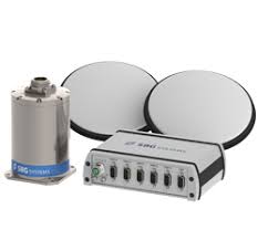
Ekinox Land Solution: Positioning & Data Georeferencing
Ekinox Land Solution combines Ekinox Inertial Navigation System with wheel speed sensor and RTK GNSS Reference Station to provide accurate positioning in a cost-effective package. To save you both time and money, we have tested and selected the best equipment to build a cost-effective and all-in-one package – Ekinox Land Solution.
Downloads
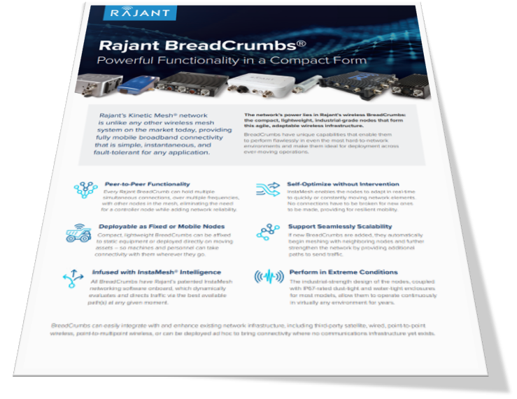
Peer to Peer Functionality
Every Rajant BreadCrumb can hold multiple simultaneous connections, over multiple frequencies, with other nodes in the mesh, eliminating the need for a controller node while adding network reliability.
Self Optimizing and Healing
Rajant’s proprietary protocol, InstaMesh, enables the nodes to adapt in real-time to quickly or constantly moving network elements. No connections have to be broken for new ones to be made, providing resilient mobility.
Seamless Scalability
If new BreadCrumbs are added to a network, they automatically begin meshing with neighbouring nodes, further strengthening the network and increasing capacity by providing additional paths to send traffic.
Ekinox Land Solution: Positioning & Data Georeferencing
Ekinox Land Solution combines Ekinox Inertial Navigation System with wheel speed sensor and RTK GNSS Reference Station to provide accurate positioning in a cost-effective package. To save you both time and money, we have tested and selected the best equipment to build a cost-effective and all-in-one package – Ekinox Land Solution.
Downloads
High Performance for a Cost-effective Solution:
- 0.05° Real-time Roll, Pitch & True Heading
- 2 cm Position (GNSS RTK)
- Post-processing Software (0.02° Roll, Pitch; 0.03° Heading)
All-in-one GNSS & Inertial Solution:
- Robust Position even during GPS Outages
- Survey Grade GNSS
- 200 Hz Output Rate
- 48h Internal Data Logger
- Rugged & Waterproof System
- Event marker at up to 1kHz
Mobile Positioning Solution: Inertial Navigation System + Odometer + RTK Base Station
Vehicle positioning in urban canyons, forest, or tunnel has always been challenging. The combination of Ekinox Inertial Navigation System with complementary technologies such as wheel speed sensor and RTK GNSS is the key to provide smooth vehicle positioning and data georeferencing even during GPS outages.